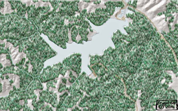
The map(s) I put out Wednesday weren't bad, but the source map was of an area I hold near & dear and the results just weren't what I wanted. For may folks they may have been just fine and I'm not begrudging people using those maps (basically I'm not taking them down), but I want to use this map in something else so I needed.....I'd argue I had to re-do them.
While I was at it I played around with Adobe Illustrator and the results weren't quite what I wanted. Actually the individual layers came out great, but trying to put everything together like I would in Photoshop was a nightmare because of the massive memory requirements. I think if I need a huge map I'll just work on the re-sized layers in Photoshop and call it good. I have to redo my tree layer in AI, but that won't be a big deal....I just forgot to tell AI to "ignore white" so I didn't get the opaque layer I wanted.
Here is a side-by-side comparison of the maps, with the new maps available after the break. Maps A & B are the old ones and C&D are the new ones.
Maps A&B had too many "artifacts" of obvious human intervention and map A just looked too much like a "regular" map you'd get from the USGS....even though I had manipulated everything. I also didn't like how the contour lines came out and were on both maps. The trees were done too quickly and I think I really missed out on making them "pop".
 |
| My favorite, Map038c |
Maps C&D are pretty much identical, save for the contour lines. I did a similar tree fill, but I edged everything with hand-placed trees which soften the edges considerably. The creeks/rivers were hard to see through the trees so I added another somewhat opaque water layer to make it more noticeable. Some work with the relief layer really helps add something extra, or so I think, to the woods. Lastly I added some roads...well more like wagon-wheel ruts. I figured I could have added in road beds and other vegetation, but I really wanted the contrast between wooded areas and everything else.
If you want the new maps, here is the link for Map C, which is without contours, and here is Map D, with contours. The contour interval has been deliberately removed to make it easier to place.
Late Afternoon Edit: I figured out what I wanted to do with the map and wouldn't you know it, but I needed a winter version of the map! Luckily I had an idea on how to pull this off and I think the end results were worthwhile.
This is it...no more tweaking....I promise.
 |
| Map038e Winter |
 |
| Map038f Winter (with Contours) |
You can just click on these two maps for the download link.


0 comments :
Post a Comment