I was trying to track down a lead I had on getting topographic patterns for making my own maps. I'm not exactly sure what that particular resource was going to look like, but I stumbled upon the United States Geographical Survey National Map Viewer.
Wow, is this thing awesome! It is basically a specialized web browser that lets you look around at US maps. When you find a view you like you can "order" a map. There are several different options to choose from, but if you order the PDF map you'll get a download link emailed to you. Then the real fun begins.
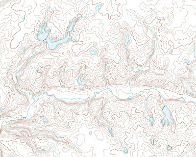
Once you get the map you can start playing with it. The map is layered and you can just start going through and checking off which layers you don't want. If you remove everything but the water and the topographical lines you will have a rich canvas with which to start your own map.
Take this map below:
There is no scale on this map. Is it 50 miles....500? The "real" map has a contour interval of 5' and this map is probably less than 10 square kilometers, but this map can be whatever I want. It could be a major river gorge separating two warring kingdoms. I could put a major fort or two in some flat or well-protected areas.
There are a ton of possibilities.
Now Imagine if I wanted to draw this out. How long do you think it would have taken? This map took me less than 10' to look up, order, and manipulate. I'd say that was a Frugal use of my time.


0 comments :
Post a Comment